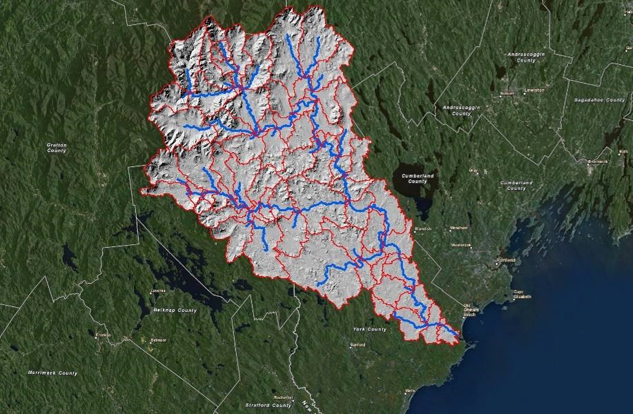
Saco River Watershed for University of New England, Biddeford, ME
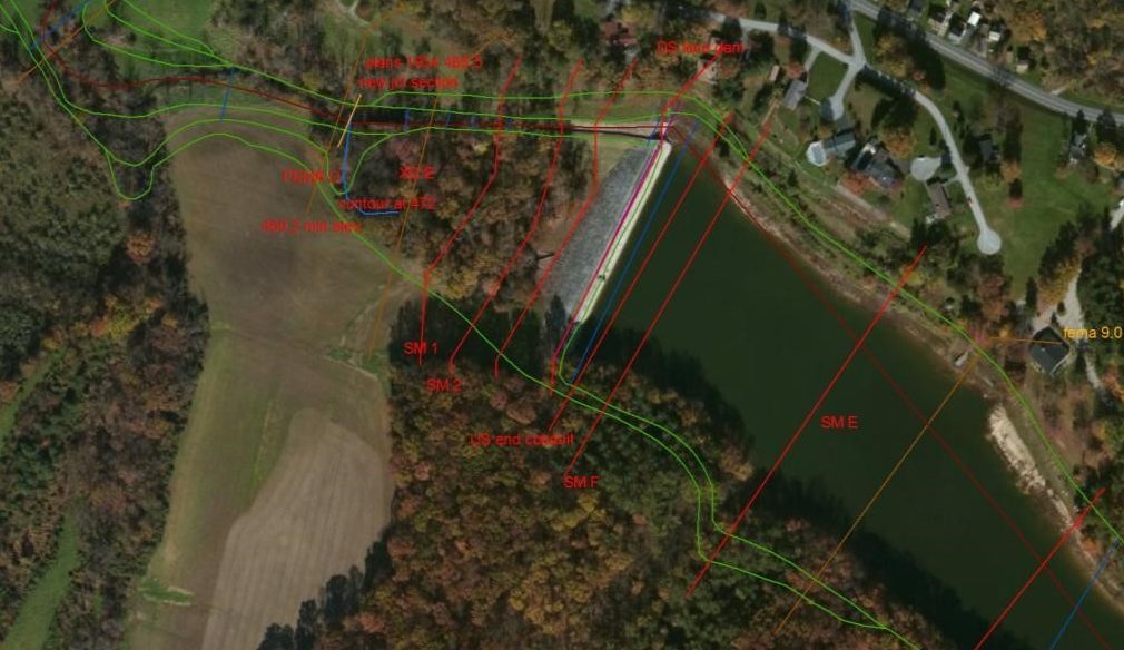
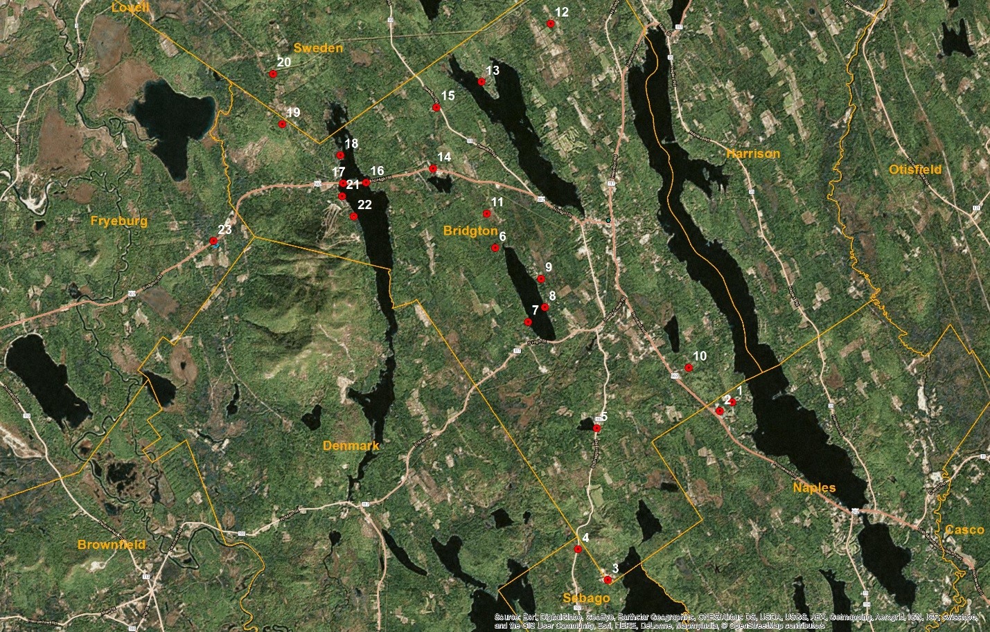
Hydrologic multi-state model for researching fluvial-tidal interactions This model is designed to assist University researchers with understanding the freshwater component of the Saco River outlet area where tidal and freshwater flows meet and interact. The model was developed using ArcGIS, Geo HMS and HECHMS to create a simulation of the Saco River Basin. The model can be used to simulate design storms such as a 100-year, 24-hour rainfall event or can simulate the impacts of actual recorded NEXRAD data from real storm events. The model incorporates GIS based land use, watershed, soils, and topographic information, as well as river sections,…